Bahamas Devastated by Hurricane Dorian
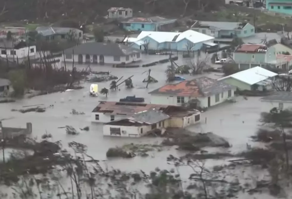
Hurricane Dorian roared into the Bahamas as a Category 5 hurricane and it has caused widespread damage across the region.
Here's Dorian At a Glance from The Weather Channel:
- Dorian continues to pound the northwest Bahamas.
- A life-threatening storm surge of up to 23 feet is reported on Grand Bahama Island.
- A hurricane warning and a storm surge warning have been issued for a part of Florida's east coast.
- Dorian is a threat from Florida to southeast Virginia this week.
- What part of the coast experiences hurricane conditions remains uncertain and is dependent on the exact track.
- Residents along the Southeast coast should have their hurricane plans ready and monitor Dorian closely.
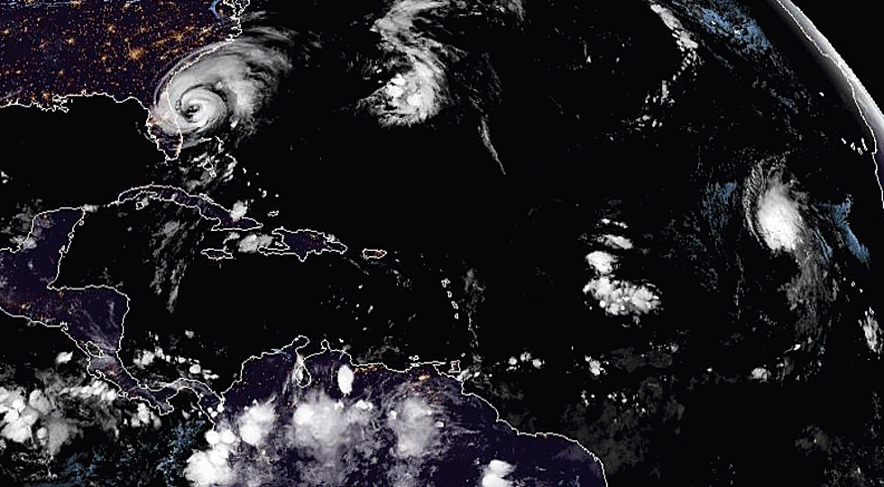
Hurricane Dorian has stalled, continuing its siege on the northwestern Bahamas, but will track dangerously close to a long swath of the East Coast from Florida to Georgia, South Carolina, North Carolina and southeastern Virginia this week.
Dorian's intensity has backed off ever so slightly from yesterday's peak and is now a strong Category 4, as it has finally undergone an eyewall replacement, common to all intense tropical cyclones during which its intensity diminishes as a new outer eyewall forms, chokes off its former inner eyewall and contracts inward. Despite that, it is still a formidable hurricane, and will remain so over the next several days.
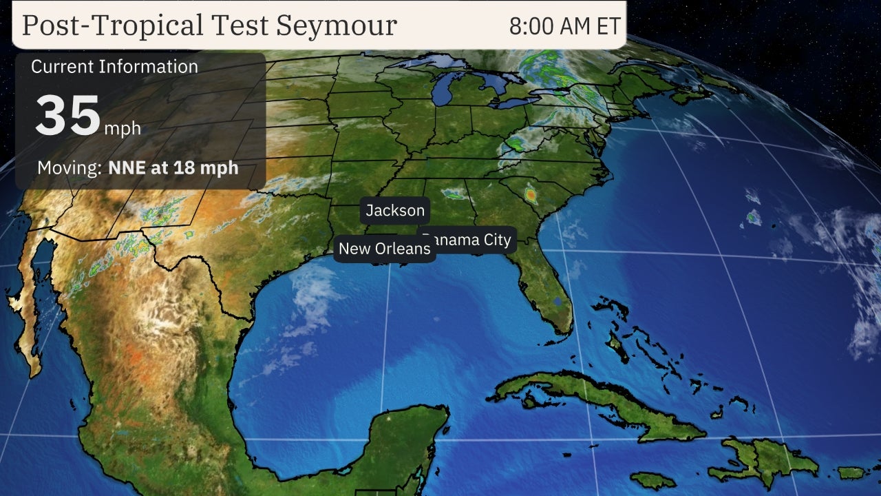
Dorian's forward speed has slowed to a virtual stall near Grand Bahama Island.
Unfortunately, that means the northwest Bahamas, in particular Grand Bahama Island, are taking an extended pummeling from destructive winds and catastrophic storm surge flooding.


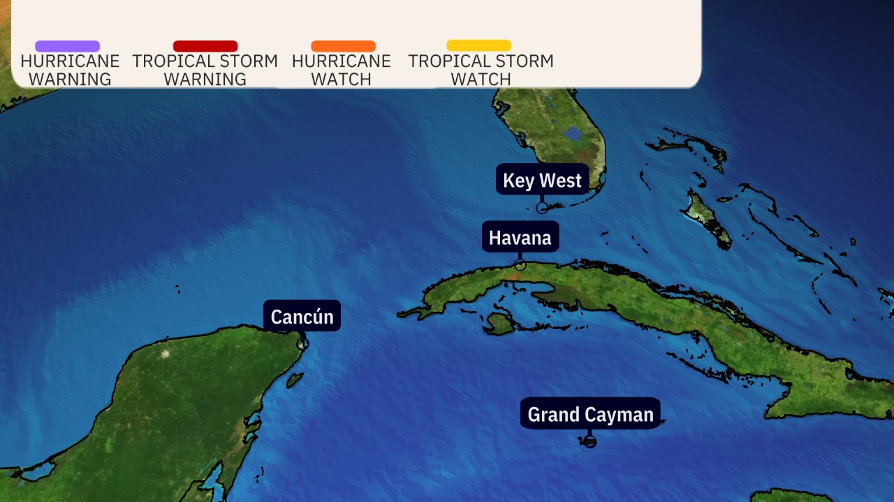
Watches and Warnings
A hurricane warning has been posted along the east coast of Florida from Jupiter Inlet to the Flagler/Volusia County line. A storm surge warning has also been issued from Lantana to the Flagler/Volusia County line. These warnings include Melbourne and Daytona Beach.
A hurricane warning remains in effect for Grand Bahama and the Abacos Islands in the northwestern Bahamas, including Freeport, Grand Bahama.
Hurricane warnings mean that hurricane-force winds (74-plus mph) are expected somewhere within the warning area, generally within 36 hours. Preparations to protect life and property should be rushed to completion.
Storm surge warnings mean there is a danger of life-threatening inundation, from rising water moving inland from the coastline, within the warning area during the next 36 hours. If you live in an area prone to storm surge, be sure to follow the advice of local officials if evacuations are ordered.
A hurricane watch has been posted along Florida's east coast from north of Deerfield Beach to Jupiter Inlet and from the Flagler/Volusia County line northward to the Altamaha Sound in Georgia (just north of St. Simons Island). A storm surge watch has also been posted in Florida from north of Deerfield Beach to Lantana and from the Flagler/Volusia County line to the Savannah River in Georgia. These watches include Jacksonville, Florida, and Brunswick, Georgia.
Hurricane watches are issued when hurricane-force winds are possible within the watch area. They are posted 48 hours before the first tropical-storm-force winds (39-plus mph) are expected. A storm surge watch means that a life-threatening inundation is possible within the watch area during the next 48 hours.
A tropical storm warning has been posted along the east coast of Florida from north of Deerfield Beach to Jupiter Inlet, meaning tropical-storm-force winds are expected within 36 hours. This warning includes West Palm Beach.
A tropical storm watch is in effect for portions of Florida's east coast from north of Golden Beach to Deerfield Beach, as well as for Lake Okeechobee. This watch includes Fort Lauderdale and Hollywood, Florida.
Tropical storm watches mean winds of 39 mph or greater are possible within 48 hours.
Monday: Dorian will still be hammering the northwestern Bahamas as it crawls slowly. Bands of rain and strong winds may affect parts of Florida. Tropical-storm-force winds (39-plus mph) are expected in the tropical storm and hurricane warning areas of eastern Florida, with hurricane-force winds (74-plus mph) possible as soon as late Monday night in the hurricane warning area. How strong the winds will be depends on how close the center of Dorian is to the Florida coast, which is still uncertain at this time. Battering waves, coastal flooding and beach erosion will increase along the southeastern coast of Florida.
Tuesday: Dorian will still be hammering the northwestern Bahamas, but conditions should slowly improve by night. Bands of rain and strong winds will still affect parts of Florida. Hurricane-force winds are expected in the hurricane warning area of eastern Florida. Coastal flooding and beach erosion will spread northward along the Florida coast.
Wednesday: Dorian is expected to move north, then northeastward near the coasts of northeastern Florida, Georgia, and southern South Carolina. The exact track is very uncertain, ranging from a track far enough offshore to keep hurricane-force winds away from land to a landfall anywhere in this zone. Storm-surge flooding, damaging winds and flooding rain are all possible in these areas.
Thursday: Dorian is expected to pass near the coasts of northeast South Carolina and North Carolina. The exact track is very uncertain, ranging from a track far enough offshore to keep hurricane-force winds away from land to a landfall anywhere in this zone. Storm-surge flooding, damaging winds and flooding rain are all possible in these areas. Some impacts from wind and coastal flooding could spread as far north as the Virginia Tidewater and the southern Delmarva Peninsula late.
Friday-Saturday: Dorian is then expected to race off the Northeast Seaboard but could track close enough to bring rain and some wind to the Virginia Tidewater, Delmarva Peninsula, Nantucket, Martha's Vineyard and Cape Cod before it heads toward the Canadian Maritimes by the weekend.
(MORE: Potential Northeast Impacts From Dorian)

(The red-shaded area denotes the potential path of the center of Dorian. It's important to note that impacts – heavy rain, high surf, coastal flooding and winds – with any tropical cyclone usually spread beyond its forecast path.)
Dorian's Track Uncertainty
Dorian's forecast track continues to be the razor's edge between more severe hurricane impacts reaching land, compared to those impacts staying barely offshore.
The reason for this is the upper-level high-pressure system that had been steering Dorian west has fizzled, stalling Dorian temporarily in an environment without a steering wheel.
Over the next day or so, a gap between upper ridges east of Dorian and over the southern Plains of the U.S. should allow Dorian to turn north. Late in the week, a southward dip in the jet stream approaching from the Great Lakes should grab Dorian and accelerate it toward the Canadian Maritimes.
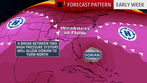
Exactly when it makes those north and northeastward turns is critical. If those turns occur later, it's more of a landfall danger, or at least an eyewall strike, for parts of the Southeast coast. If it makes those turns sooner, the threat of a landfall is less, particularly in Florida and Georgia.
The myriad of track possibilities range from a Florida landfall and track northward through part of the Florida Peninsula to a landfall somewhere in the Carolinas to a long scrape of the Southeast coast without the center ever moving ashore to a sharper northeastward turn well offshore.
Regardless of its exact track, Dorian is likely to be a dangerous hurricane this week near the Southeast coast. Residents should have their hurricane plans ready to go and follow the directions of local emergency management.
As we saw with Hurricane Matthew in 2016, a hurricane doesn't have to make landfall in an area to produce significant impacts.
Dorian's Storm Surge, Wind and Rain Impacts
Bahamas
On Grand Bahama Island, a life-threatening storm surge may cause water levels to be as much as 18 to 23 feet above normal tide level in areas of onshore winds. Near the coast, that storm surge will be accompanied by large, destructive waves.
Damaging hurricane-force winds will persist much of Monday, perhaps into Tuesday in the northwest Bahamas.
Rainfall totals of 12 to 24 inches are expected in the northwestern Bahamas, with isolated amounts up to 30 inches, which may cause life-threatening flash flooding, the National Hurricane Center said. The central Bahamas can expect an additional 1 to 3 inches, with isolated totals up to 6 inches.
Southeastern U.S.
Larger swells and increased battering waves generated by Dorian are beginning to arrive along the Southeast coast from North Carolina to eastern Florida and will persist for several days.
This will lead to increasing beach erosion and coastal flooding, particularly around times of high tides, which are generally around 10 to 11 a.m. and p.m. each day.
These impacts will occur regardless of how close Dorian's center tracks or whether it ever moves ashore in any part of Florida, Georgia or the Carolinas.
More From 99.9 KTDY




![[PICS] Hurricane Hunter Captures Eerie Pic Of The Eye Of Hurricane Dorian](http://townsquare.media/site/33/files/2019/09/Dorian.png?w=980&q=75)
