![Hurricane Laura Timeline, Storm Surge Info, Wind Speeds and More [Video]](http://townsquare.media/site/180/files/2020/08/Screenshot_261.jpg?w=980&q=75)
Hurricane Laura Timeline, Storm Surge Info, Wind Speeds and More [Video]
Hurricane Laura is currently is still making its way to the Louisiana/Texas line and with Cameron Parish in its sights. So, what time will we see conditions deteriorate, how bad will the storm surge be, how much rain will we get, and when will it all be over? Here's what we know.
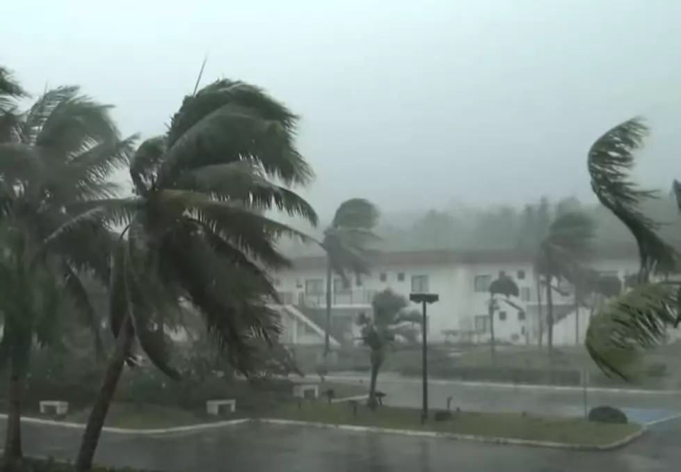
1 PM UPDATE - Hurricane Laura is now an extremely dangerous category 4 hurricane with maximum winds of 140 MPH. Little time remains to protect life and property before water levels begin to rise and winds increase in the warning areas.
Now, as you'll hear Daniel Phillips say in the video below, movement 10 to 20 miles east or west with Hurricane Laura clearly will change expected conditions greatly.
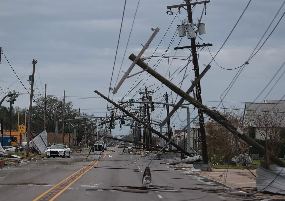
NOAA reports hurricane-force winds are expected tonight in "portions of the hurricane warning area from San Luis Pass, Texas, to the west of Morgan City, Louisiana, with catastrophic wind damage expected where Laura's eye wall makes landfall."
Lafayette is approximately 109 miles from the Texas/Louisiana State line where the eye of Laura is forecast to make landfall, with more western areas of Acadiana obviously closer. However, this close to landfall, the impact information is usually pretty spot on.
Q) When will Hurricane Laura make landfall?
A) As of right now, Hurricane Laura is expected to make landfall is expected as a Category 4 with winds at 145 mph right at the Louisiana/Texas border at around 12:00 am tonight/tomorrow morning.
Q) What kind of winds will we get in Acadiana?
A) Hurricane Laura will is expected to make landfall around Cameron Parish with winds of up to 120 mph with gusts as strong as 130 mph. Daniel Philips from KATC says winds in "Acadiana will be sustained around 30-50 mph, but those winds will be exponentially worse the further west you go and the wind gusts in Acadiana will be around 40-60 mph, and in western Acadiana could be between 80-100 mph."
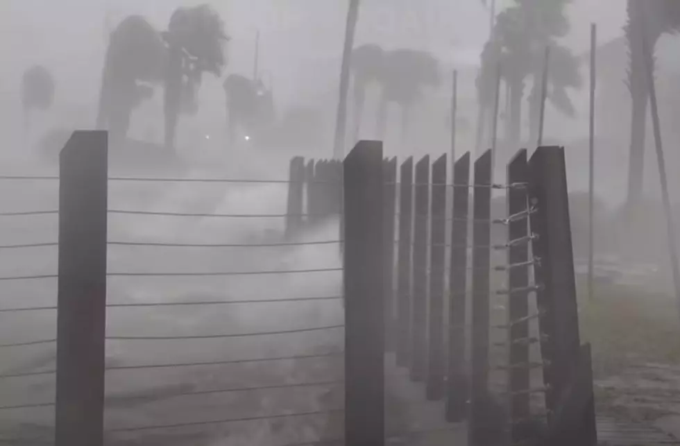
Q) How bad will the storm surge be?
A) The storm surge in Louisiana from Hurricane Laura as of now is expected to be 10-15 feet between Intracoastal City and Sabine Pass. KATC says that saltwater in some areas will make as far north as the I-10 corridor.
Q) How much rain will Acadiana get?
A) For the most part, we can expect an average of about 5-10" of rain in central and eastern parts of Acadiana. However, some isolated areas could see 15" of rain depending on where Hurricane Laura's heavier rain bands whip through as the storm travels north.
Q) When will the rain and wind start for Acadiana?
A) It looks like Acadiana will start seeing bands begin to travel through somewhere around noon and will continue off and on throughout the day as Hurricane Laura gets closer to landfall. We can expect winds to accompany the rain bands, increasing in speed systematically as the day goes on. Around 5 pm today we should begin to see slightly heavier and more frequent rain bands travel though.
More From 99.9 KTDY