Here’s the Timing for This Weekend’s Severe Weather Threat
For late-night revelers Friday night you might want to keep an umbrella, a raincoat, or possibly a pirogue handy. There is a really good chance that by the time the bars begin to close Friday or more accurately early Saturday morning in Lafayette we could be in the midst of a wild weather ride.
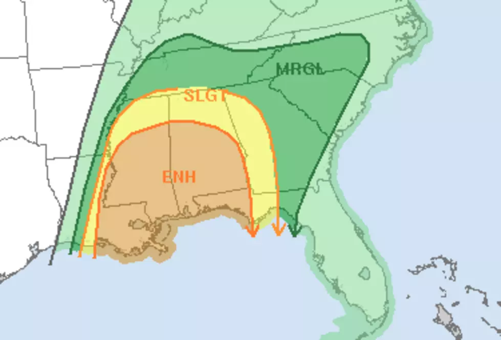
The Storm Prediction Center has placed much of South Louisiana in the "enhanced risk" zone for severe weather from about sunset Friday until mid-morning on Saturday. The catalyst behind the storm threat is a strong frontal system and low pressure. This system is expected to create big thunderstorms, some possibly severe, as it moves across Texas into Louisiana.
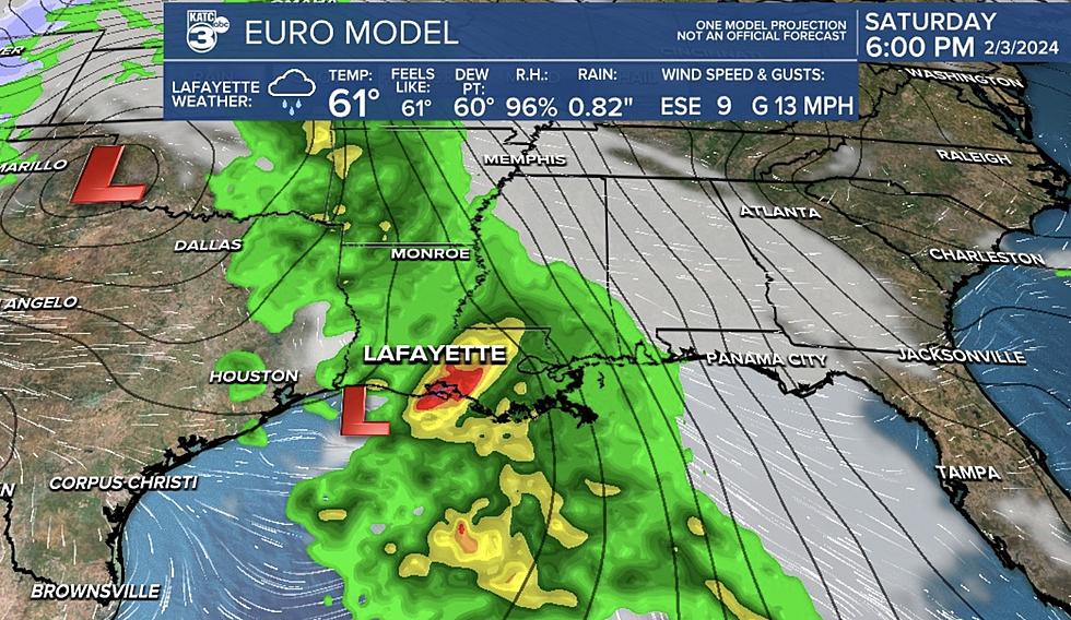
Based on the most recent run of the European Weather Model residents in extreme southwest Louisiana should start to feel the brunt of the worst of the weather by about midnight. That same model predicts the strongest storms will be arriving in the Lafayette area before Six A.M.
KATC's Rob Perillo has produced this very information graphic about when and what the biggest weather threats will be for Acadiana and when they might occur.

As you can see most of Acadiana will be under the gun early Saturday morning. That means you'll really want to make sure you have your radio handy or you've downloaded our station App and selected "WEATHER" in your settings for alerts.
One of the dangers of this particular system is not only its potential volatile weather outbreak but the timing on when the system will be moving through the area. As of now, it looks as if the system will affect South Louisiana during the dark hours. This could make spotting a severe weather event such as a tornado very difficult to do.
That's why we encourage you to keep your radio on our station or keep your television on KATC. I know Rob and his team will be up all night until it's safe again in Acadian.
More From 99.9 KTDY