Lundi Gras Will Be Wet – Mardi Gras Will Be Better
On this Monday before Mardi Gras, Lundi Gras, there could be many activities affected by showers and thunderstorms. In the early morning hours of Monday, the rain began moving into the state and it's expected to be a part of the forecast for much of the daylight hours.
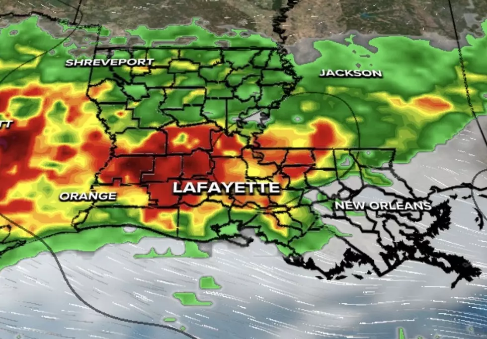
The current National Weather Service radar scan shows where the heaviest showers and thunderstorms are currently located.
Forecasters believe the rain chances will diminish as the evening wears on and the outlook for Tuesday, Mardi Gras day is much better.
An abundance of Gulf moisture is being pulled across the state by a low-pressure system centered in the Great Plains. This moisture will most likely create foggy conditions along the coastal parishes and create a better chance of rain and thunderstorms as the system to the northwest moves eastward.
The Lundi Gras forecast for the Lafayette and Lake Charles area calls for showers to continue through the early morning hours. There will be additional rainfall likely throughout the morning and into the afternoon. Rain chances across the I-10 corridor will be 60% during the day on Monday. That chance of rain will decrease to 20% by the late evening hours.
The Mardi Gras forecast will hold a slight chance of showers in the early morning followed by partly cloudy skies. The temperatures for Monday and Tuesday should be near 80 degrees for afternoon highs.
More From 99.9 KTDY