Tropical Wave Near Bahamas – Development Possible
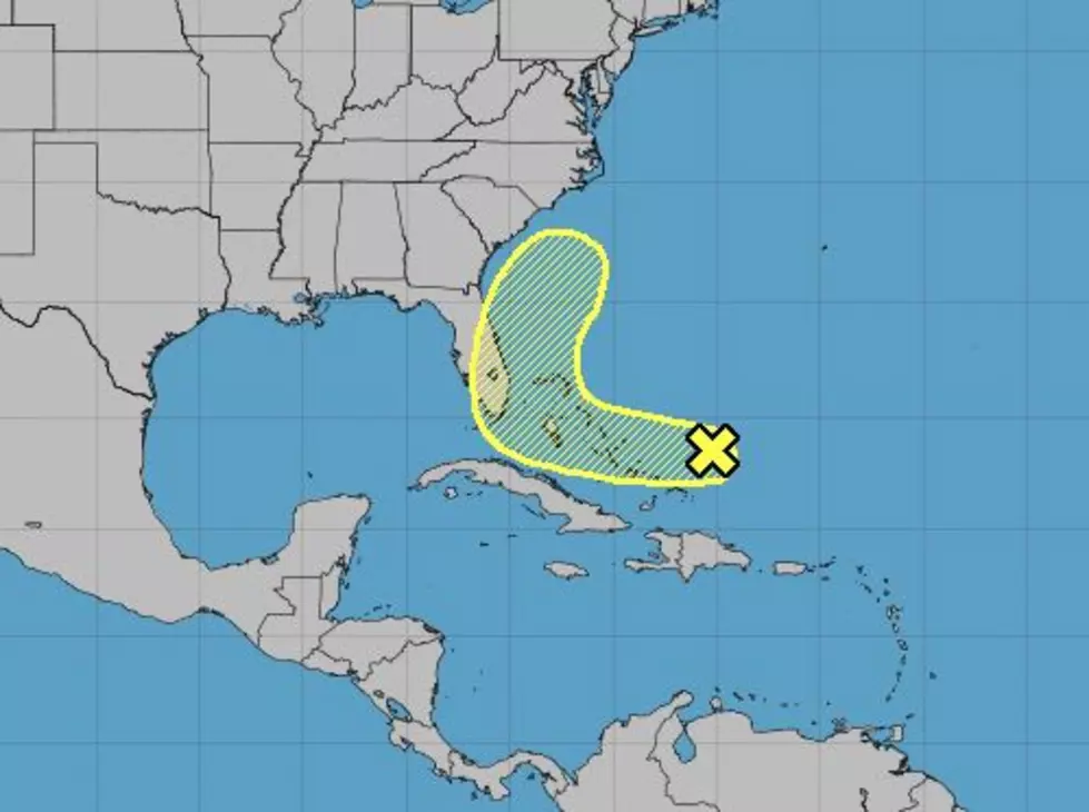
Forecasters with the National Hurricane Center are monitoring an area of disturbed weather in the tropical Atlantic Ocean. The tropical wave was producing gusty winds and tropical squalls. The storm system is expected to move slowly to the west over the next several days. This could bring inclement weather conditions to the coast of Florida by Monday.
The potential for development does not appear to be that high at this time. Over the next three days, tropical forecasters give this tropical wave a 10% chance of strengthening into a tropical cyclone. Over a five day period, that probability only increases to 20%.
The track model solutions supported by the Hurricane Center suggest this system will remain weak as it moves very close to the east coast of Florida. Then the system is expected to be pulled to the north along the east coast. This is, of course, assuming that the system holds together in its current form.
There should be no impact at all from this system on the Gulf Coast. Elsewhere in the tropical Atlantic Basin, there are no other areas being monitored for tropical development.
More From 99.9 KTDY


