Tropical System in the Gulf Expected to Strengthen
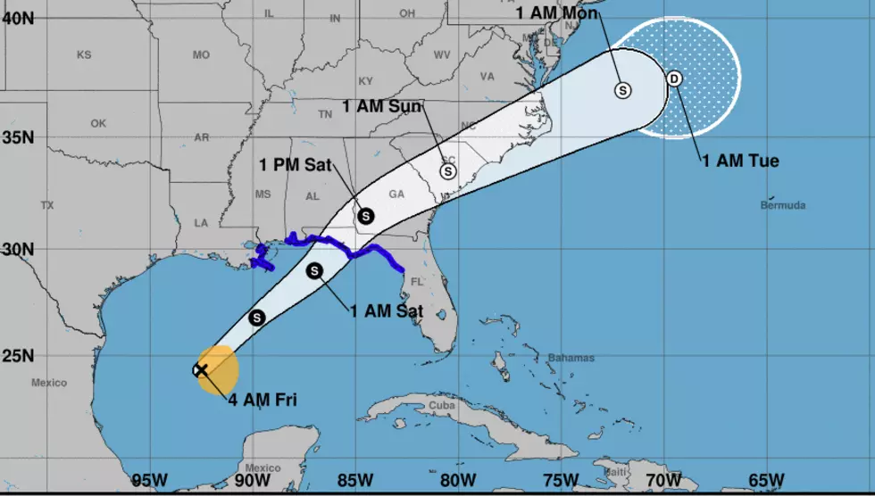
At any moment now the National Hurricane Center could redesignate "Potential Tropical Cyclone 16" as Tropical Storm Nestor. That's how close the system is to earning a name as it moves northeastward across the central Gulf of Mexico this morning.
The Hurricane Center's 4 am advisory noted that the system had maximum sustained winds at 40 mph. The center of circulation was located about 390 miles south-southwest of the mouth of the Mississippi River. The movement of the storm was to the northeast at 12 miles per hour.
Forecasters believe this motion to the northeast will continue for the next 12 to 24 hours. If that track holds true, then that would put the center of the storm several miles offshore due south of Pensacola Florida by this time tomorrow.
As of now the official intensity forecast from the National Hurricane Center does not call for this system to become a hurricane. As of now, the highest forecast winds are projected to be 50 miles per hour with some stronger gusts.
The storm system should have a minimal effect on Acadiana's forecast. However, conditions offshore will likely be affected by the close proximity of the center of circulation so boaters and anglers beware.
More From 99.9 KTDY