Strong Storms Possible Across Parts of Acadiana Today
Now that we have exited hurricane season we are entering "parade of cold fronts" season. That's because this time of year, once the tropical heat has been abated, there are usually cold fronts that pass through Louisiana about once or twice a week. This weather pattern is quite typical for our part of the country.
The issue with that weather pattern is that these cold fronts often kick up strong storms and severe weather when they move through. A front that is forecast to move through Acadiana later today is expected to bring a threat of storms to most of the area late this afternoon, tonight, and tomorrow.
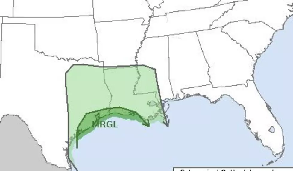
The Storm Prediction Center has placed a small sliver of southwest Louisiana and southeastern Texas in the marginal risk zone for severe storms today. The area affected in Louisiana is roughly from Lafayette to Lake Charles to the west, extending south in to the coastal waters.
Ahead of the front, a high wind advisory has been posted for much of the I-10 corridor. The National Weather Service Office in Lake Charles says wind gusts approaching tropical storm force are possible from mid-morning until the early evening hours.
Forecasters with the National Weather Service said rain chances will be on the increase this afternoon with the greatest threat of rain and storms tonight. The probability of precipitation is 40% for later today and then 80% for tonight.
Showers should linger in the area tomorrow morning and the winds should calm down considerably. Temperatures will remain cool following the front's passage. By Friday the clouds and showers should be out of the way allowing for a mostly sunny and cool weekend across the region.
Only in Louisiana' Christmas Gifts to Give
More From 99.9 KTDY