Louisiana May Be Impacted By Wintery Precipitation Early Next Week
We hope you have your jackets and gumbo pots ready for what's to come early next week in Louisiana.
For a few days now we've been hearing of this arctic blast pushing further southward and now weather models are picking up on what could be a mess for some in the deep south.
Temperatures Monday night (Jan. 15th) will plummet and we will see temps drop in the 20s, while some weather models suggest temps may be even lower than that.
We all know that water freezes at 32 degrees, so we will be way below freezing for a few nights and yes, there's a slight chance of precipitation in the forecast on those nights.
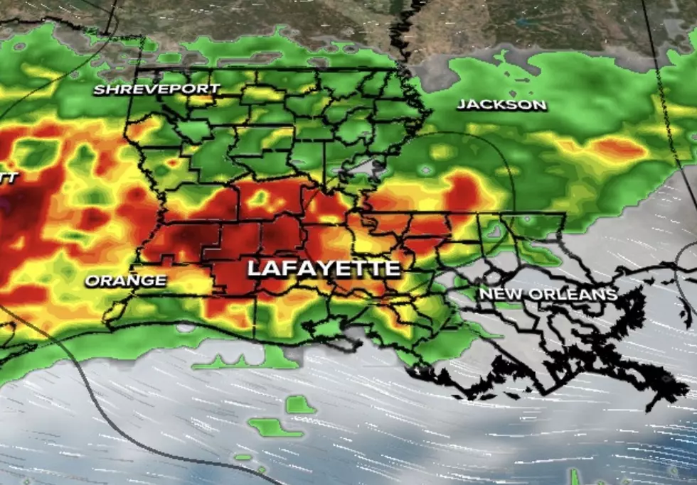
So, the big question is, will Louisiana see any wintery precipitation? Early indications suggested that would not be the case, but things may be changing.
As this arctic air moves into our region early next week, we may see sleet and ice on the roadways in portions of south Louisiana, thus you should begin to prepare to stay off the roads early next week. As for snow, we may get a flurry or two but don't expect much of the white stuff here.
We remind you, that this is all subject to change as we are a few days out, but more and more in the "weather world" are noting that many in the deep south could be impacted by ice and sleet early next week.
Therefore, you may want to do your grocery shopping by the weekend, and please make plans to take care of the pets that are outdoors.
We'll be providing more updates here in the days ahead and be sure to download this station's mobile app on your phone for further updates.
Here's another look at what's to come, as we prepare for what could be the coldest days of winter down south. Again, it's never too early to prepare for this arctic blast.
You will most certainly want to protect any pipes that are exposed to the elements.
10 Old Fisher Price Toys That Are a Blast From The Past
More From 99.9 KTDY