Hurricane Center Monitoring 3 Areas of Concern
(KMDL-FM) Just last week we reported to you that Colorado State University, one of the most respected tropical forecast operations in the world, had issued its August update on Hurricane Season 2026. The forecast is still calling for a below-average season, but with only two named storms in the books, the feeling was that there would be a sudden uptick around the peak of the season.
As of this morning, the National Hurricane Center is monitoring three areas of concern in the tropical Atlantic basin. Two of those areas of concern could affect the United States; a third is heading away from the eastern seaboard.
Hurricane Center Monitoring Three Systems in the Tropical Atlantic Basin
You can get an idea of the bigger picture from this graphic offered by the National Hurricane Center.
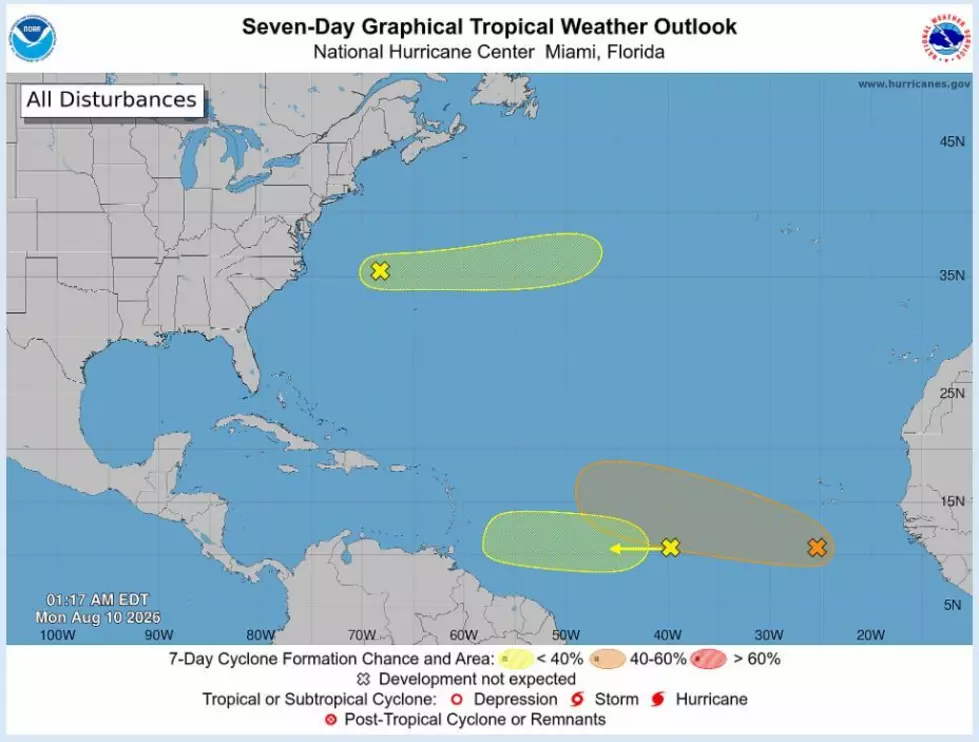
The thing you should know about these potential weathermakers at this juncture is the fact that they are out there. As of now, the potential for development appears to be more likely with the storm system that is shaded in orange. That system has been given a 60% probability to strengthen over the next seven days.
The storm system that is indicated by the yellow shading is only given a 10% chance of growing stronger. Its current track appears to bring it very close to the coast of South America. Certainly, it will be worth watching if it survives. Upper-level winds across that part of the ocean will not be conducive to tropical development.
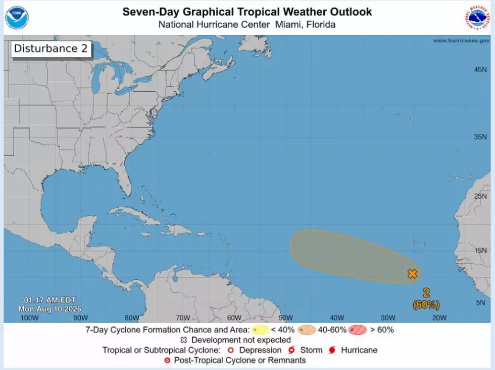
Forecasters say "system 2", the one shaded in orange, which we've isolated for you, is expected to merge with a tropical wave that is rolling off the African coast, and by midweek a tropical depression could form in the middle of the Atlantic.
Why The Sudden Explosion of Tropical Activity?
This is the time of year when this part of the tropical Atlantic becomes very active around the Cape Verde and Cabo Verde Islands. More and more tropical waves will roll off the coast of Africa and attempt to make their way westward. This is where El Niño will likely play a part.
READ MORE: Super El Niño Could Mean Louisiana Snow, Next Winter
The El Niño phenomenon is known for creating disruptive upper-level winds that disrupt cyclone development. This could certainly happen to this system, or it could be affected by steering currents around the subtropical ridge, also known as the Bermuda High, and it could be pulled northward and eventually back out to sea.
READ MORE: 20,000 Louisiana Residents Share a Name with This Potential Hurricane
There is still a lot of time and distance that will have to be covered before we will have to consider any real threat to any populated coastline. The main thing to know is the tropics are still active and will be that way, especially for the next eight weeks as we are entering the peak of the tropical season.
Hurricane Landfall Probabilities Revealed: Parish-by-Parish Breakdown